Introduction
At Maptaskr we fundamentally believe that maps make it easier to see correlations between data, and to contextualise what is happening on the ground quicker than any other form of visual information. Maptaskr provides the capability to –
-
Combine & consume high-end mapping & geospatial data
-
Combines CRM, ERP & Enterprise Mapping data together into one solution
-
Integrates into leading enterprise mapping platforms like ESRI
-
Combine infrastructure/asset data with customer data
-
Import high resolution aerial imagery
-
Perform geospatial analysis
We blend business data with location intelligence and artificial intelligence to bring you insights and actions that will make your business better-organised, more productive, and more profitable. Maptaskr is democratising what is normally found in high-end location intelligence and GIS software, making it super easy to use.
As the saying goes, “a picture paints a thousand words”. With these being some of our guiding principles, we built Maptaskr to be as quick, easy, and intuitive as possible, so all Users can get access to the information they need, when they need, and even trigger actionable processes from within the map. This approach of interacting with data through a map leads to time and cost savings for your business.
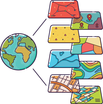
Figure 1: Maptaskr enables Geospatial visualisations.
Features
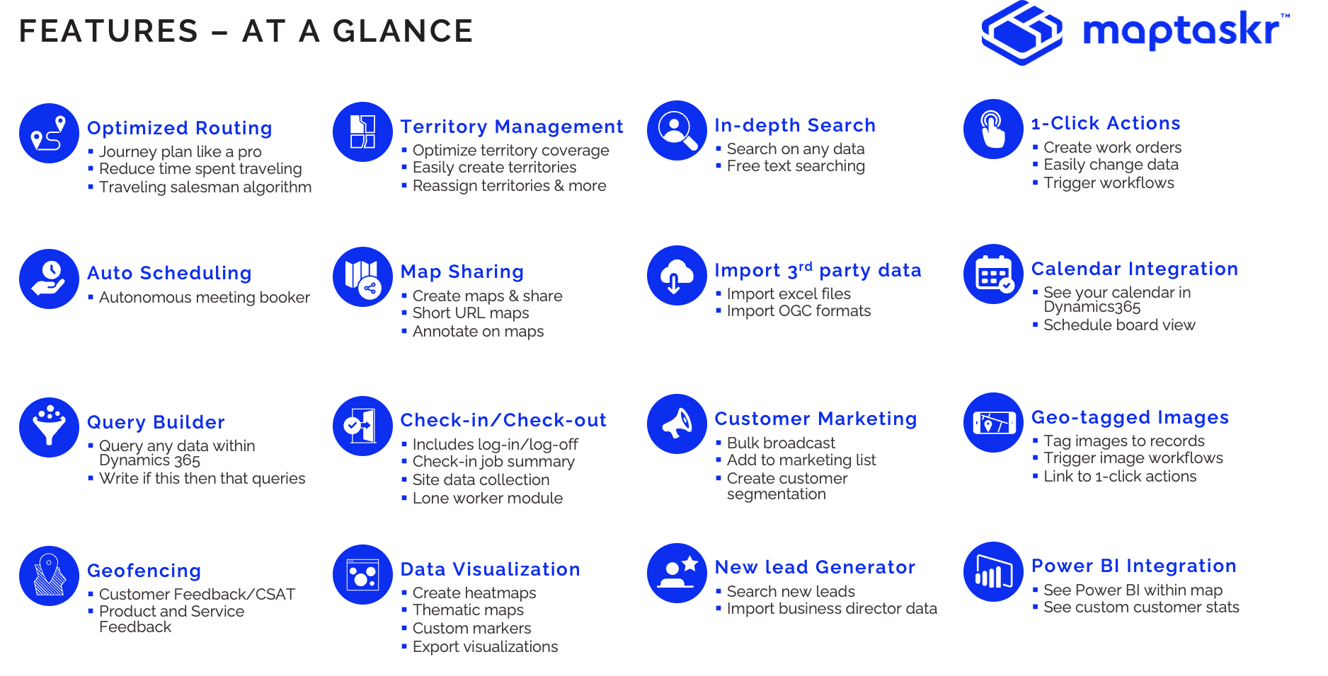
Maptaskr is feature rich and provides a broad range of capabilities to end users. From in-depth searching to routing, it enables users to perform their required function seamlessly from a unified interface.
The figure below provides an overview of some of the features available to Maptaskr users.
Figure 2: Maptaskr features at a glance.
Mobility
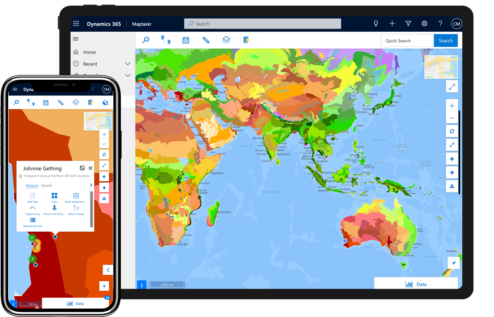
As a Microsoft First Party solution, Maptaskr is able to provide all is features and capability in a mobile-friendly manner either via responsiveness within a mobile device browser, or within Microsoft compatible apps. Maptaskr works within Power Apps mobile and Dynamics 365 for phones and tablets app.
Figure 3: Maptaskr on mobile devices.
Purpose
Maptaskr is an application that integrates spatial data from your enterprise and public domain web information, making them available via a web browser.
This guide gives a brief overview of Maptaskr and provides step-by-step guidance on how to make the most of your Maptaskr product.
Note: Please keep in mind that not all the features or functionality may be available to users in your organisation’s installation of Maptaskr, as they may not be configured of turned on by your organisation for use.
For Administration information, refer to the Maptaskr Installation and Configuration guide.
Intended Audience
This guide is intended for Maptaskr end users.
The Maptaskr user-interface is designed to be clear, concise, and easy-to-use. This guide it is provided to help you to get started, and as a quick reference guide to support you if you get stuck and get an understanding of some of the more advanced features.
Note: This guide does not provide guidance on the use and functionality of the general base platform Maptaskr is installed to work within i.e. Dynamics 365 or the Power Platform. This knowledge is assumed.
Supported Browsers and Devices
As a native Microsoft native software product, Maptaskr supports the same browsers and devices as determined by Microsoft – Dynamics CE Supported Browsers and Devices.